


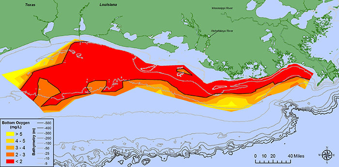
The U.S. National Oceanic and Atmospheric Administration (NOAA) issued a news release stating that scientists have determined this year’s Gulf of Mexico ‘dead zone,’ an area of low oxygen that can kill fish and marine life, is 8,776 square miles, an area about the size of New Jersey.
It is the largest measured since dead zone mapping began there in 1985. This large dead zone size shows that nutrient pollution, primarily from agriculture and developed land runoff in the Mississippi River watershed is continuing to affect the nation’s coastal resources and habitats in the Gulf.
The annual forecast, generated from a suite of NOAA-sponsored models, is based on nutrient runoff data from the U.S. Geological Survey. Both NOAA’s June forecast and the actual size show the role of Mississippi River nutrient runoff in determining the size of the dead zone.
This large dead zone size shows that nutrient pollution, primarily from agriculture and developed land runoff in the Mississippi River watershed is continuing to affect the nation’s coastal resources and habitats in the Gulf.
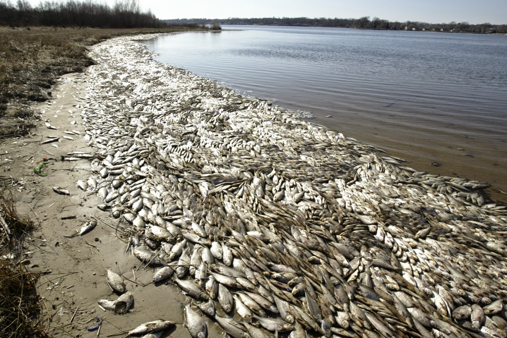
These nutrients stimulate massive algal growth that eventually decomposes, which uses up the oxygen needed to support life in the Gulf. This loss of oxygen can cause the loss of fish habitat or force them to move to other areas to survive, decreased reproductive capabilities in fish species and a reduction in the average size of shrimp caught.
The Gulf dead zone may slow shrimp growth, leading to fewer large shrimp, according to a NOAA-funded study led by Duke University. The study also found the price of small shrimp went down and the price of large shrimp increased, which led to short-term economic ripples in the Gulf brown shrimp fishery.
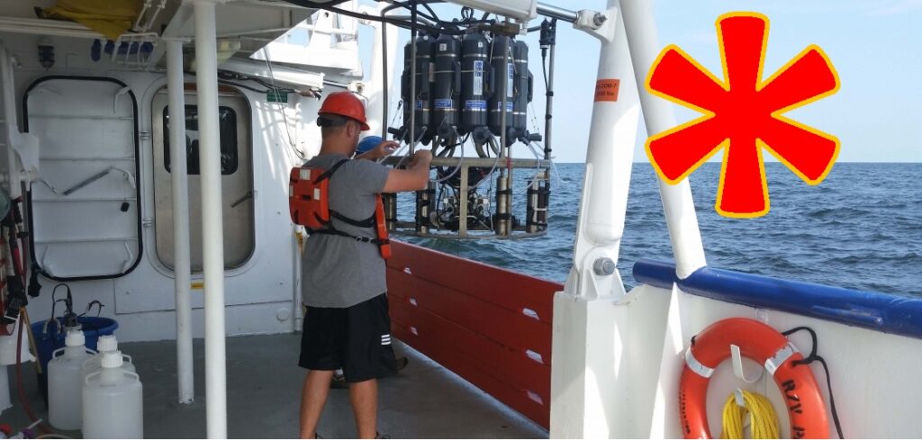
A team of scientists led by Louisiana State University and the Louisiana Universities Marine Consortium collected data to determine the size of the dead zone during a survey mission from July 24 to 31 aboard the R/V Pelican.
“We expected one of the largest zones ever recorded because the Mississippi River discharge levels, and the May data indicated a high delivery of nutrients during this critical month which stimulates the mid-summer dead zone,” said Nancy Rabalais, Ph.D., research professor at LSU offsite link and LUMCONoffsite link, who led the survey mission.
“Having a long-term record of the size of the Gulf of Mexico dead zone is vital in forecasting its size, trends and effects each year,” said Steven Thur, Ph.D., acting director of NOAA’s National Centers for Coastal Ocean Science. “These measurements ultimately inform the best strategies for managers to reduce both its size and its impacts on the sustainability and productivity of our coastal living resources and economy.”
Previously the largest Gulf of Mexico dead zone was measured in 2002, encompassing 8,497 square miles. The average size of the dead zone over the past five years has been about 5,806 square miles, three times larger than the Gulf Hypoxia Task Force target of 1,900 square miles.
NOAA funds monitoring and research efforts to understand the dead zone in the Gulf of Mexico through its Northern Gulf of Mexico Ecosystems & Hypoxia Assessment program, known as NGOMEX. The annual dead zone measurement is used by the Gulf of Mexico/Mississippi River Watershed Nutrient Task Force to determine whether efforts to reduce nutrient pollution in the Mississippi River basin are working. New initiatives such as the Runoff Risk Advisory Forecast are designed to help farmers apply fertilizer at optimum times to limit nutrient runoff to the Gulf.
LUMCON’s Gulf Hypoxia websiteoffsite link has additional graphics and information about this summer’s research mission as well as missions in previous years.
Source: NOAA


Reblogged this on Brittius.
Reblogged this on Mar Equinoccial and commented:
Sea “dead zone” at the Gulf of Mexico: the largest ever measured